← Back
Article image
πŸ“° News ⏱ 2 min
πŸ”‘

Key Points

4 points
1

First Indian imaging satellite for geosynchronous orbit launched.

2

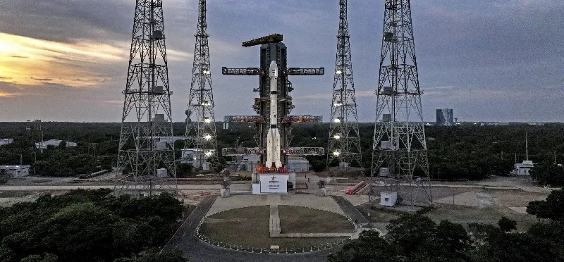
Rocket: three‑stage, 51.7 m tall, with a cryogenic upper stage.

3

Orbit altitude: roughly 36,000 km, allowing the satellite to stay over the same region.

4

Purpose: provide real‑time images for farming, flood monitoring, and other services.

πŸ“–

Summary

The three‑stage Geosynchronous Satellite Launch Vehicle rocket lifted off from Satish Dhawan Space Centre at 2:55 am after a 27‑hour countdown.

The satellite will hover about 36,000 km above Earth, matching the planet’s rotation, and deliver real‑time Earth‑observation data.

The data will support agriculture, disaster management, and other national needs.

πŸ“˜

New Words to Learn

11 words
geosynchronous
an orbit where a satellite moves at the same speed the Earth rotates, staying above the same area
cryogenic
extremely cold fuel used in rockets to give a powerful push
altitude
how high something is above the ground or sea level
rotational speed
the speed at which the Earth spins on its axis
anomaly
something that did not work the way expected
abort
to stop a mission early because of a problem
mission
the overall plan and purpose of a space flight
payload
the satellite or equipment that the rocket is carrying
launch pad
the platform where a rocket is positioned before it takes off
Satish Dhawan Space Centre
India's main spaceport where rockets are launched
real‑time
information that is received instantly, without delay
πŸ”— Read Full Article β†’

Want to learn even more? Click here to read the full story!

πŸ”Š Reading Article
Kid-friendly voice
πŸ†

New Badge Unlocked!

Badge Name
Badge description